|
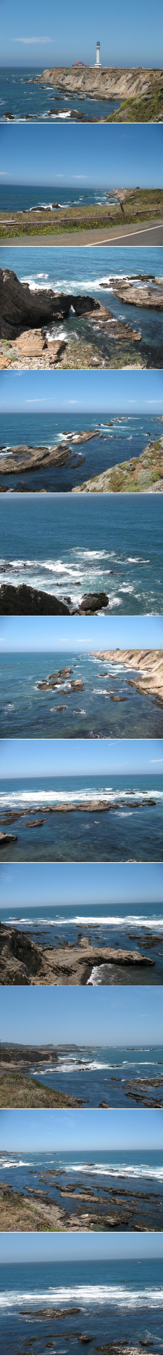
Scenic Drive to Point Arena, California Point arena-Stornetta public lands is the public land surrounding the lighthouse at point arena. This is not to be confused with the town at the south end of the public lands, which is nearest Arena bay. These pictures are from the area around the lighthouse and offshore from the public lands looking out toward the State Marine conservation area. The coastline is beautiful, with the cliffs and beautiful ocean views along up and down the coast enroute to Point Arena, from where we're staying up in Sea Ranch 25 miles south of there. It was a beautiful day, except for a little haze that came in off the ocean. An interesting feature of the coastline off the public lands near the lighthouse is the offshore upturned sedimentary rocks where you can see the layers of the sedimentary rocks because they have been rotated 90 degrees. In the pictures you can also see an arch that has been eroded out of the rock. On another occassion we had lunch at the restaurant on the highway 1 end of the public lands where there is a restaurant. called the Rollerville cafe. Not sure where the name came from the service was good and the food was ok. On the drive back home, we stopped a couple places to view the coastline, to take pictures. |
|
|
|
Information Sharing in the wanderers' community
|
||
email feedback to: trikerbiker73@outlook.com
note it has been said that not all that wander are lost
Last Update: August 1, 2016
Copyright 2016 all rights reserved