|
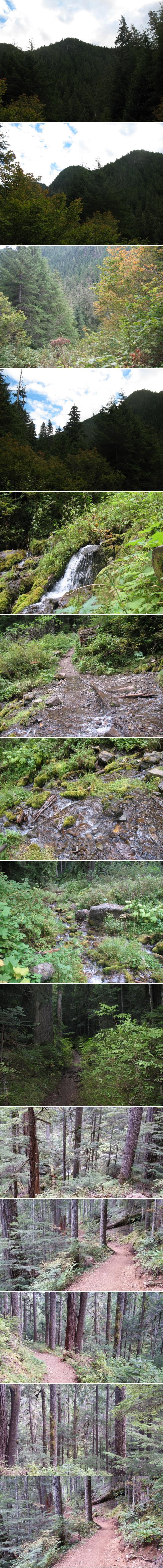
Hike up Upper Big Quilcene trail - part 2 The Upper Big Quilcene trail has some impressive views up on the ridge at Marmot pass in the Olympic mountains. This trail leads to a network of backpacking trails in the national forest bordering the national park. The washington trail association is a really great resource for hikers in the washington area. I highly recommend that association. Besides the great information they provide about the trails, they organize a lot of good deeds relating to trails repair and development. It's a great organization, perhaps the best volunteer organization in the nation for hiking trails. If I lived in Washington, I would certainly join the association. It's a great group of people. Here are the driving directions thanks to the WTA post for this trail..... Leaving from Quilcene drive US 101 south for 1.5 miles. (From Shelton follow US 101 north for 50.5 miles.) Turn right (west) onto Penny Creek Road. After 1.5 miles bear left onto Big Quilcene River Road (Forest Road 27). Drive 9.25 miles, turning left on FR 2750. Continue 4.75 miles to the trailhead. Privy is available at the trailhead. The roads are over all pretty good, paved for quite a bit of the way, passenger cars should have no trouble reaching this trailhead. When I hiked this trail, I was suffering severe anemia( I found out later in December when I had my annual checkup ), and it felt like it was much harder for me to breathe than normal, so I only hiked a little more than 3 miles one way up the mountain, just over 6 miles round trip. The trail actually goes about 10 miles+ round trip, so I went a little more than half way, and the trail gains over 3,000 feet, but my shortened route never got above the trees, and had only about 1,600 feet elevation gain, but the forest views were pretty nice along the creek.(see pictures) The pictures that I captured were only of the Olympic peninsula rain forest, which certainly has it's charms, however, I also like the views from the ridge, so I regret my having had to turn around and miss out on the views up at Marmot pass on the ridge. The trail follows the creek right up westward up the mountainside, and ends up on the ridge at Marmot pass. The day that I decided to take on this hike, it was partly cloudy, and nice and cool. At about 4,000 feet where it was the coolest on my trek, it wasn't too bad with just my sweathshirt. There were lots of interesting views up and down the trail, but I suspect the real view is up on the top. Going up the trail, Quilcene creek is pretty, and there are lots of views of trees and moss and all the signs of it being a rain forest. It was a good hike, even only having gone up about half way. I hope to come back to the area in a year or so and I'd like to go up this route and do a few days of backpacking, and get some more good pictures up on the ridge and along the route. It's a great hike, and not too hard at all. The trailhead is a little out of the way, but really not much worse than many of the trailheads in Olympic national forest. It's well worth taking this hike when you're in the area, and best of all, you can take your dog!! |
| |
|
Information Sharing in the wanderers' community
|
||
email feedback to: trikerbiker73@outlook.com
note it has been said that not all that wander are lost
Last Update: Sept 08, 2017
Copyright 2016, 2017 all rights reserved